A Day in the Life of Dry Run Creek
The University of Northern Iowa resides within the Dry Run Creek Watershed. Watersheds are specific high and low areas on a landscape that help to channelize and move water downhill. There are many important factors within a watershed including biology, chemistry, geology, land use practices and citizens. As Dry Run Creek flows through our landscape it provides access to our natural world, wildlife habitat, recreation and most important opportunities to learn about the history and future of our home.
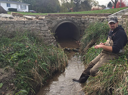
Tyler Dursky participating in the 2016 UNI Geomorpholgy class.
Documents
2016/17 University of Northern Iowa, Student Dry Run Creek Geomorphic Assessment
2012 Iowa DNR, Source Water Protection, Cedar Falls Groundwater Investigation
2012 Iowa Geological Survey, STATEMAP, Surficial Geology of Cedar Falls
2012 Iowa Geological Survey, STATEMAP, Bedrock Geology of Cedar Falls
2011 Iowa DNR, Watershed Improvement Section, Dry Run Creek Report
Links
Black Hawk County Soil and Water Conservation District – Dry Run Creek
ArcGIS Story Maps, Dry Run Creek, Sanctuary Sites
ArcGIS Story Maps, Dry Run Creek, Best Management Practices
City of Cedar Falls, Iowa Dry Run Creek
Iowa Dept. of Agriculture and Land Stewardship, Dry Run Creek Watershed
Iowa Department of Natural Resources - REAP-CEP and the University of Northern Iowa Iowa's Rivers and Her Valleys
Images -
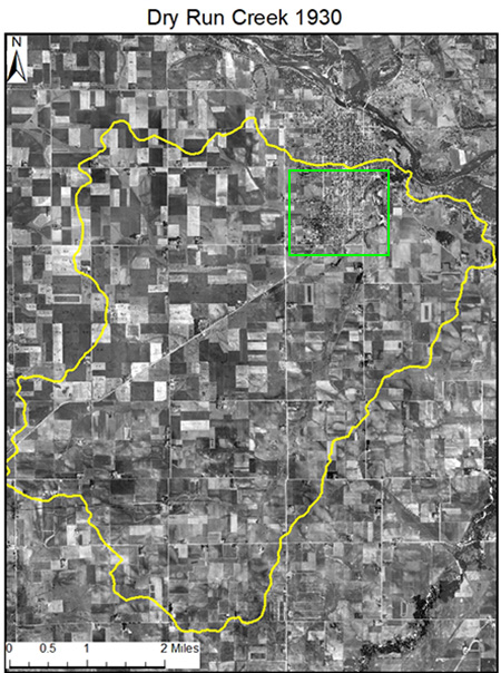
The green squre represents the city of Cedar Falls in 1930, the yellow line is the boundary for our Dry Run Creek Watershed. Hold your mouse/cursor over the image to see how much has changed upto 2017, both images use an USDA aerial photograph from 1930.